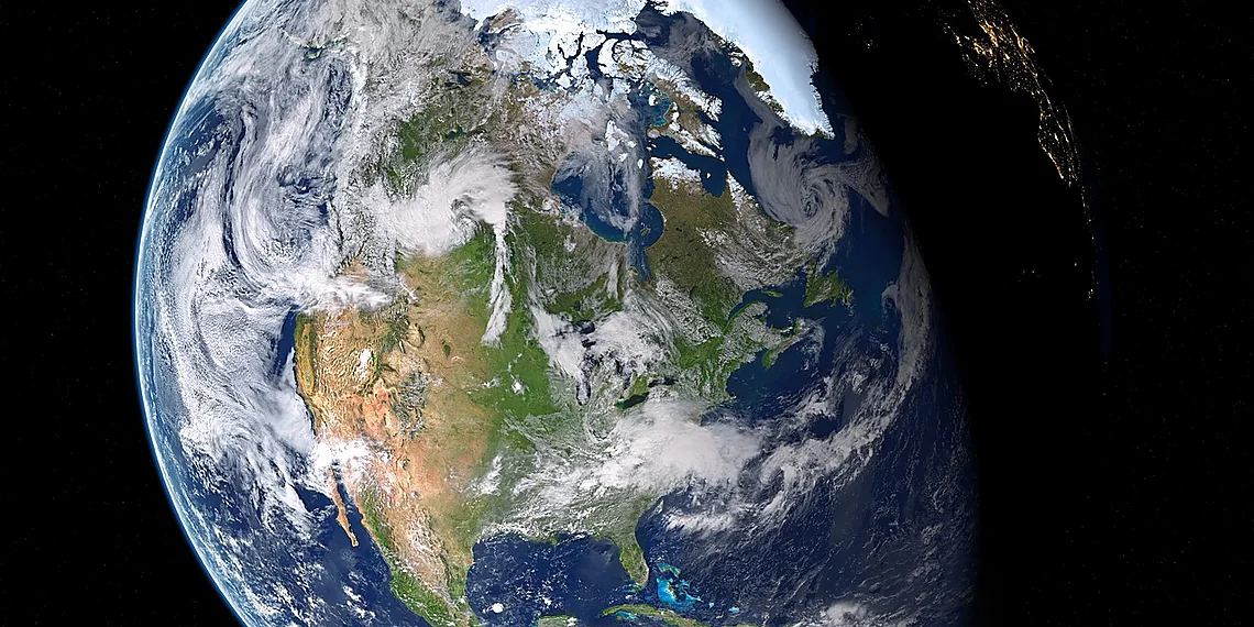
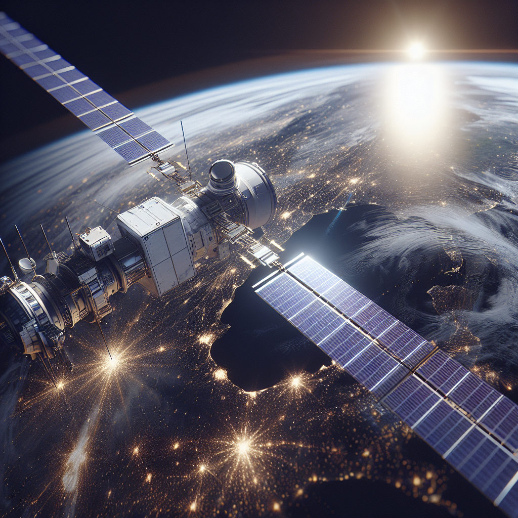
The world of Earth observation is on the cusp of a significant leap forward, and excitement is building for an imminent arrival. Get ready to welcome Sentinel-1D, the newest member joining Europe’s groundbreaking Copernicus program. This isn’t just another satellite; it represents a vital expansion of our ability to monitor our planet’s changing landscapes.
Copernicus itself is a phenomenal initiative, providing free and open access data for environmental monitoring and security applications globally – and Sentinel-1D is poised to amplify its impact considerably. The existing Sentinel-1 constellation has already provided invaluable insights into everything from deforestation to disaster response, but the addition of this satellite promises even greater temporal resolution and coverage.
Imagine near real-time radar imagery across vast areas, enabling quicker responses to natural disasters or providing more frequent updates on critical infrastructure. With its advanced capabilities, Sentinel-1D will significantly enhance our understanding of Earth’s surface processes, contributing to a safer and more sustainable future for all.
Understanding Sentinel-1D’s Mission
Sentinel-1D represents a significant boost to Europe’s Earth observation capabilities, but what exactly *does* it do? Unlike optical satellites that rely on sunlight, Sentinel-1D uses radar – specifically Synthetic Aperture Radar (SAR) – to ‘see’ the Earth. This is crucial because SAR allows imaging regardless of weather conditions; think through thick cloud cover or during nighttime operations. It transmits microwave pulses towards the Earth’s surface and analyzes the reflected signals to create detailed images. These images aren’t just pretty pictures, they provide vital data about everything from ice sheet thickness and deforestation rates to oil spills and land subsidence – information that would be completely unavailable using traditional optical methods.
The real power of Sentinel-1D lies in its enhanced capabilities compared to its predecessors in the Sentinel-1 constellation. It builds upon existing SAR technology with improved signal processing and wider swaths, meaning it can cover more ground area per orbit. This increased efficiency allows for faster data collection and a more frequent update cycle for critical monitoring applications. Critically, the satellite’s dual-polarization capabilities provide richer information about surface characteristics – distinguishing between different types of vegetation, identifying changes in soil moisture, or even detecting subtle shifts in building structures. It’s not just ‘observing’ Earth; it’s actively probing its surface with radar waves to reveal hidden details.
Sentinel-1D isn’t operating in isolation; it’s a vital component of the broader Copernicus program, a European Union initiative aimed at understanding and managing our planet sustainably. Copernicus is one of the world’s largest Earth observation programs, providing data for a wide range of applications including climate change monitoring (tracking sea level rise, glacier melt), disaster response (assessing flood damage or volcanic activity), maritime surveillance, and agricultural management. Sentinel-1D’s contribution to this program strengthens Europe’s ability to address these global challenges with timely and reliable data – essentially acting as a critical ‘eye in the sky’ for a safer and more sustainable future.
The upcoming launch aboard an Ariane 6 rocket marks a significant milestone, not just for ESA but for the entire Copernicus program. With Sentinel-1D joining the existing constellation, we’ll see even greater geographical coverage and data availability. This expanded capacity translates directly into improved insights across numerous sectors – from environmental scientists needing to track deforestation patterns to emergency responders requiring real-time flood maps. It’s a powerful demonstration of how advanced technology can be deployed for the benefit of society, providing crucial information that informs decision-making and ultimately helps us better understand and protect our planet.
Enhanced Radar Capabilities
Sentinel-1D represents a significant upgrade to the existing Sentinel-1 constellation, all of which utilize Synthetic Aperture Radar (SAR) technology. Unlike optical satellites that rely on sunlight, SAR uses radio waves emitted by the satellite itself to create images. This key difference allows Sentinel-1D to ‘see’ through clouds and darkness, providing crucial data regardless of weather conditions or time of day – a major advantage for monitoring environmental changes like deforestation, flood mapping, and ice sheet movement in regions with frequent cloud cover.
The improvements on Sentinel-1D aren’t just about all-weather imaging; it also boasts enhanced radar capabilities compared to its predecessors. It features an improved signal processing chain which allows for greater detail in the generated images, enabling more precise measurements of ground deformation and surface characteristics. Furthermore, the satellite’s increased operational flexibility means it can be tasked with different observation modes and swaths (width of the area imaged), adapting to specific user needs and providing a wider range of data products.
Beyond scientific research and disaster response, Sentinel-1D’s advanced SAR capabilities have practical applications in numerous industries. These include supporting maritime surveillance for security purposes, monitoring oil spills, assisting in agricultural management by assessing crop health, and even contributing to infrastructure monitoring like pipeline integrity assessments. The expanded bandwidth and flexible imaging modes of Sentinel-1D promise to unlock even more innovative uses for Earth observation data.
Copernicus Program Context
The Copernicus Programme, spearheaded by the European Union, is an ambitious Earth observation initiative aiming to provide crucial data for environmental monitoring, civil security applications, and informed policymaking. It’s not a single satellite but a constellation of satellites – including the Sentinel series – combined with ground stations and user services. The program’s objectives encompass understanding climate change impacts, managing natural resources sustainably, protecting our planet, and improving humanitarian response efforts globally.
Within Copernicus, Sentinel-1D represents a vital addition to the existing Sentinel-1 fleet. As part of this constellation, it’s dedicated to radar imaging – meaning it uses radio waves instead of light to create images, allowing it to ‘see’ through clouds and darkness. This capability is particularly valuable for monitoring changes in land surfaces like deforestation, ice sheet dynamics (crucial for sea level rise predictions), and tracking oil spills.
Beyond environmental applications, Sentinel-1D’s radar data plays a significant role in disaster response, providing rapid assessments of flood damage or earthquake impacts. It also contributes to security applications such as maritime surveillance and border monitoring, offering valuable insights for various stakeholders – from scientists and policymakers to emergency responders and security agencies. The launch of Sentinel-1D enhances the overall resilience and capabilities of the Copernicus Programme.
The Launch Campaign: A Detailed Look
The journey of Sentinel-1D from assembly to launchpad is a testament to meticulous planning and extraordinary engineering precision. The recent fueling operations, captured in images showing the satellite bathed in the Kourou sunlight, represent just one critical stage in this complex campaign. Fueling a satellite isn’t as simple as filling a tank; it involves carefully transferring cryogenic propellants – liquid oxygen and hydrogen – into specialized fuel tanks while maintaining extremely low temperatures and ensuring absolute purity to prevent contamination of sensitive instruments. Stringent safety protocols are paramount throughout the process, involving multiple redundant systems and highly trained personnel dedicated to minimizing any potential risk.
The decision to fuel Sentinel-1D relatively close to launch (just days before) is a strategic one driven by several factors. Cryogenic fuels, due to their extremely low temperatures, tend to ‘boil off’ over time, gradually reducing the available propellant. Storing these fuels for extended periods would necessitate elaborate and costly refrigeration systems. Furthermore, minimizing the storage duration reduces the risk of any unforeseen issues arising with the propellants themselves. This close-to-launch fueling represents a delicate balance between logistical efficiency and maintaining sufficient fuel reserves for orbital insertion.
Once fueled, Sentinel-1D underwent encapsulation – a crucial step that protects the satellite from aerodynamic forces and thermal extremes during its ascent through Earth’s atmosphere. The payload fairing, a large protective shell, is carefully positioned around the satellite within a cleanroom environment to prevent any dust or contaminants from entering. Following encapsulation, the integrated satellite and rocket system was then meticulously mated with the Ariane 6 launcher. The Ariane 6 represents a new generation of European launch vehicles, designed for increased flexibility and efficiency in deploying payloads into orbit, and its role is to precisely propel Sentinel-1D towards its designated operational orbit.
The entire process – from fueling to encapsulation and integration with the Ariane 6 – underscores the immense complexity involved in space exploration. Each step requires coordinated effort across numerous teams of specialists, demanding unwavering attention to detail and a commitment to safety at every level. The successful execution of these preparations is essential for ensuring that Sentinel-1D can fulfill its vital mission of providing crucial Earth observation data as part of the Copernicus program.
Fueling Operations
Fueling a satellite like Sentinel-1D is an incredibly delicate and hazardous operation, demanding meticulous planning and stringent safety protocols. The process involves transferring cryogenic propellants – liquid hydrogen and liquid oxygen – into the spacecraft’s fuel tanks. These substances are extremely cold (liquid hydrogen hovers around -253°C) and volatile, requiring specialized handling equipment and highly trained personnel to prevent leaks, explosions, or damage to the satellite itself. Multiple redundant safety systems are in place, including leak detection sensors, emergency shutdown procedures, and a ‘buddy system’ where technicians constantly monitor each other’s actions.
The decision to fuel Sentinel-1D so close to the planned launch date (typically within 24-36 hours) is driven by technical constraints. Liquid hydrogen, in particular, tends to ‘boil off’ – gradually evaporating due to heat transfer with its surroundings – even when stored at extremely low temperatures. Storing large quantities of cryogenic fuel for extended periods would result in significant losses, impacting the satellite’s operational lifespan and potentially jeopardizing the mission. Therefore, fueling as close as possible minimizes this boil-off time.
Adding another layer of complexity is the need to ensure the fuel’s purity. Contaminants can interfere with engine performance or even cause catastrophic failures. Prior to fueling, extensive checks are performed on both the satellite’s tanks and the transfer lines to guarantee cleanliness. Furthermore, the entire process is carefully choreographed to minimize exposure of sensitive satellite components to extreme temperatures and vibrations, further emphasizing the precision required in preparing Sentinel-1D for its journey into orbit.
Encapsulation & Ariane 6 Integration
Before a satellite can embark on its journey to orbit, it must be carefully encapsulated within a protective payload fairing. This process, known as encapsulation, shields Sentinel-1D from aerodynamic forces and extreme temperatures during ascent through Earth’s atmosphere. At Europe’s Spaceport in Kourou, French Guiana, the satellite was meticulously positioned inside the fairing, a complex structure comprised of multiple segments that are assembled around the spacecraft. This operation requires precise alignment and secure fastening to ensure Sentinel-1D remains undisturbed throughout launch.
Following encapsulation, Sentinel-1D is integrated with the Ariane 6 rocket, Europe’s newest heavy-lift launcher. The Ariane 6 is designed to replace both the Ariane 5 and Soyuz rockets, offering enhanced performance and flexibility for future missions. It incorporates a new upper stage engine (Vinci) which provides precise orbital insertion capabilities crucial for placing Sentinel-1D into its designated Sun-synchronous orbit – an orbit that allows it to pass over the same point on Earth at the same local time each day.
The integration process itself is highly intricate, involving mechanical and electrical connections between the satellite’s interfaces and those of the rocket. Engineers conduct rigorous checks to verify all systems are nominal before declaring the combined stack ready for launch. The Ariane 6’s robust design and advanced features are critical in ensuring Sentinel-1D reaches its operational orbit successfully, continuing the vital Earth observation work of the Copernicus programme.
Technical Specifications & Innovations
The Sentinel-1D mission represents a significant advancement in Earth observation, largely driven by its sophisticated technical design. At its core lies an advanced Synthetic Aperture Radar (SAR) instrument, the backbone of its imaging capabilities. This SAR system operates within the C-band frequency range, offering robust performance even under challenging weather conditions like cloud cover and rain – a critical advantage for consistent global monitoring. Its resolution is capable of providing detailed imagery, allowing for observation of features as small as 5×20 meters in interferometric wide swath mode and 10×20 meters in single look complex mode, enabling precise analysis of surface changes and environmental phenomena.
Beyond the SAR instrument itself, Sentinel-1D incorporates several innovative design choices to enhance its operational efficiency. The satellite utilizes a high-power solar panel array for electricity generation, ensuring ample power for both onboard processing and data transmission. Precise orbit maintenance is achieved through a combination of chemical propulsion systems – strategically placed thrusters that allow for fine adjustments to the satellite’s position and attitude. This precision is essential for maintaining the constellation’s tight formation flying capability, enabling highly accurate interferometry which combines multiple SAR images to generate detailed 3D representations of Earth’s surface.
A key innovation within Sentinel-1D lies in its contribution to the overall Sentinel-1 constellation’s enhanced capabilities. The satellite is specifically designed for close formation flying with existing Sentinel-1 satellites (A, B and C), significantly improving the accuracy and resolution of interferometric SAR data. This ‘piggyback’ approach allows for a denser network of observations over critical areas, facilitating more timely responses to events such as floods or volcanic eruptions. The constellation’s combined capabilities provide unprecedented insights into changes occurring across our planet.
Finally, Sentinel-1D benefits from lessons learned and technological refinements applied throughout the Sentinel program. This includes improvements in data processing pipelines and onboard autonomy, enabling faster data delivery and reduced reliance on ground station support. These ongoing advancements not only enhance the effectiveness of individual missions but also contribute to the long-term sustainability and scientific value of the entire Copernicus Earth observation program.
Sensor Technology Breakdown
Sentinel-1D, like its predecessors in the Sentinel-1 constellation, utilizes a Synthetic Aperture Radar (SAR) instrument for Earth observation. SAR technology allows the satellite to image the Earth’s surface regardless of weather conditions or time of day, providing valuable data for various applications such as environmental monitoring, disaster response, and maritime surveillance.
The SAR sensor on Sentinel-1D operates at a C-band frequency (approximately 5.4 GHz). This band offers a good balance between penetration capabilities – allowing it to see through cloud cover and vegetation – and sensitivity to surface changes. The instrument is capable of multiple imaging modes, including Stripmap, Interferometric Wide Swath (IW), Extra Wide Swath (EW), and Wave Mode, each tailored for specific data requirements.
Resolution capabilities vary depending on the selected mode. In Stripmap mode, Sentinel-1D achieves a ground resolution of approximately 5 x 20 meters, providing detailed imagery. Interferometric modes enable measurements with sub-meter precision, crucial for applications like measuring land deformation and glacier movement. The wide swath width (approximately 250 km) allows for extensive area coverage in each pass.
Power & Propulsion Systems
Sentinel-1D, like other satellites in the Sentinel constellation, relies on solar panels for primary power generation. These photovoltaic arrays convert sunlight directly into electricity to operate the satellite’s instruments, communication systems, and onboard computers. The specific surface area and efficiency of the solar panels are carefully calculated during design to ensure sufficient power is available throughout the satellite’s operational lifespan, considering factors like orbital position and panel degradation over time.
Maintaining a stable orbit for Sentinel-1D necessitates a propulsion system capable of counteracting gravitational forces and atmospheric drag. The satellite utilizes chemical propulsion – typically small thrusters using hydrazine or similar propellants – to perform periodic orbit correction maneuvers. These adjustments ensure the satellite remains precisely positioned within its designated orbital plane, crucial for consistent data acquisition and accurate radar imaging.
The design of the propulsion system prioritizes both effectiveness and longevity. While powerful enough to execute necessary corrections, the thrusters are operated sparingly to conserve propellant resources, extending Sentinel-1D’s operational lifetime. Precise orbit determination and control algorithms minimize the frequency and magnitude of these maneuvers, contributing to overall mission efficiency.
Future Implications & Data Accessibility
The arrival of Sentinel-1D promises a significant boost to numerous industries reliant on Earth observation data, ushering in an era of enhanced monitoring capabilities across the globe. Imagine farmers utilizing high-resolution radar imagery to precisely assess crop health and optimize irrigation strategies, leading to increased yields and reduced resource waste. Maritime surveillance will benefit from improved vessel tracking and ice detection, bolstering safety and environmental protection efforts. Urban planners can leverage detailed maps generated from Sentinel-1D data for infrastructure development and disaster mitigation planning – identifying vulnerable areas and proactively implementing preventative measures. Even in the realm of emergency response, the satellite’s ability to penetrate cloud cover and darkness will be invaluable for assessing damage and coordinating relief efforts following natural disasters like floods or wildfires.
Beyond these core applications, Sentinel-1D’s advanced radar capabilities open doors to entirely new avenues of research and innovation. Scientists can analyze subtle ground deformation changes, providing critical insights into volcanic activity or land subsidence. Geologists will benefit from enhanced mapping of geological features, aiding in resource exploration and hazard assessment. The satellite’s dual-polarization capabilities offer a richer dataset for analyzing surface properties – allowing researchers to distinguish between different types of vegetation or identify variations in soil moisture content. This wealth of information empowers a more nuanced understanding of our planet’s dynamic processes.
Crucially, the power of Sentinel-1D isn’t restricted to large institutions or specialized agencies; its data is freely and openly accessible to everyone. The European Space Agency (ESA) maintains a robust open data policy, ensuring that researchers, students, entrepreneurs, and citizen scientists alike can leverage this valuable resource without cost or complex licensing agreements. Data can be easily accessed through the Copernicus Open Access Hub ([https://scihub.copernicus.eu/](https://scihub.copernicus.eu/)), alongside a variety of processing tools and tutorials designed to facilitate data analysis, regardless of technical expertise. This commitment to accessibility fosters collaboration and accelerates innovation across diverse sectors.
The launch of Sentinel-1D represents more than just the addition of another satellite to an existing constellation; it signifies a continued dedication to providing global Earth observation data that is both powerful and accessible. By combining advanced technology with an open data philosophy, ESA empowers individuals and organizations worldwide to tackle pressing challenges, drive scientific discovery, and build a more sustainable future – all fueled by the insights gleaned from this orbiting sentinel.
Applications Across Industries
Sentinel-1D’s radar imagery, like that from its predecessors, offers a wealth of opportunities across diverse sectors, largely due to its ability to penetrate clouds and operate day or night. In agriculture, farmers can utilize Sentinel-1D data for precision farming techniques, monitoring crop health, assessing soil moisture levels, and estimating biomass – all crucial for optimizing irrigation and fertilizer use, ultimately boosting yields and reducing environmental impact. For example, early detection of stress in crops caused by drought or disease becomes possible, allowing for targeted interventions.
Maritime surveillance benefits significantly from Sentinel-1D’s capabilities. The satellite’s radar can detect oil spills, track ships, monitor sea ice extent (vital for navigation safety), and assess coastal erosion. This information is invaluable to coast guards, environmental agencies, and shipping companies alike. Urban planning also stands to gain; detailed maps generated from Sentinel-1D data facilitate urban expansion monitoring, infrastructure assessment (detecting ground deformation or subsidence), and the identification of informal settlements, informing sustainable development strategies.
Perhaps most critically, Sentinel-1D’s near-real-time imagery will bolster disaster response efforts. Following events like floods, earthquakes, or landslides, the satellite’s data can quickly provide an overview of affected areas, aiding in damage assessment and coordinating relief operations. The fact that all Sentinel-1 data is freely and openly accessible ensures broad utilization by researchers, NGOs, governmental bodies, and anyone else needing this vital Earth observation information, fostering innovation and collaboration globally.
Open Data Policy & Accessibility
A cornerstone of the Copernicus programme, Sentinel-1D’s data is freely and openly accessible to everyone, fostering innovation across numerous sectors including agriculture, disaster management, maritime surveillance, and security. This commitment to open data ensures that valuable Earth observation insights are not restricted but rather widely available for research, commercial applications, and public benefit.
Accessing Sentinel-1D imagery is straightforward through the Copernicus Open Access Hub (). Here, users can search, download, and process data using various tools and formats. The ESA’s Sentinel Science Hub () provides additional resources like tutorials, datasets, and documentation to assist in utilizing the satellite’s capabilities effectively.
Beyond these primary hubs, third-party platforms often aggregate and simplify access to Sentinel data, offering user-friendly interfaces and pre-processed products. Examples include Google Earth Engine and cloud-based geospatial analysis services. The consistent availability of this data, coupled with robust online resources, dramatically lowers the barrier to entry for leveraging advanced Earth observation technology.
The successful deployment of Sentinel-1D marks a significant leap forward in our ability to monitor Earth’s surface, providing invaluable data for everything from disaster response to agricultural management.
With its enhanced capabilities and redundancy within the constellation, we can anticipate even more robust and timely observations, bolstering existing monitoring programs and opening doors to new research avenues.
The extended lifespan of this mission promises a wealth of information across Europe and beyond, supporting critical decision-making in areas like climate change mitigation and resource management – Sentinel-1D’s contribution will be particularly valuable for tracking subtle changes over time.
Looking ahead, the synergy between all Sentinel satellites, including Sentinel-1D, will continue to refine our understanding of our planet’s dynamic processes, offering unprecedented insights into environmental challenges and opportunities. The data generated is a testament to international collaboration and technological innovation in Earth observation science. It’s truly an exciting time for those working with remote sensing technologies and their applications globally. We believe the potential unlocked by this mission will only continue to grow as researchers and practitioners find new ways to leverage its capabilities. Further advancements in processing techniques will undoubtedly reveal even more detail from these powerful datasets, pushing the boundaries of what’s possible in Earth observation analysis. The consistent data stream allows for a level of long-term trend analysis previously unattainable with older systems. This is just the beginning of Sentinel-1D’s operational journey and its impact on our understanding of the world around us will be profound. We are eager to see how future applications emerge from this incredible resource.
Source: Read the original article here.
Discover more tech insights on ByteTrending ByteTrending.
Discover more from ByteTrending
Subscribe to get the latest posts sent to your email.