

Revolutionary AI Model Boosts Image Geolocation Efficiency
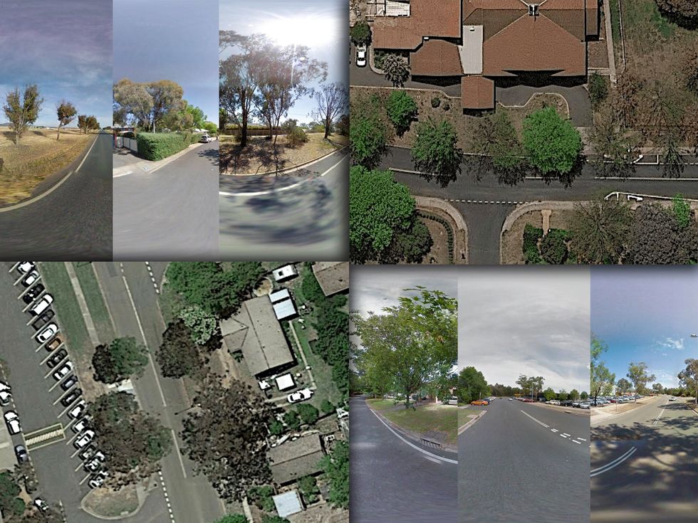
Imagine playing a new version of GeoGuessr, tasked with matching street-side photos to aerial views. A recent advancement in machine learning offers a solution – an AI model developed by researchers at China University of Petroleum (East China) that drastically improves the speed and memory efficiency of image geolocation. This innovative system promises significant benefits for navigation and even defense applications.
Understanding Deep Cross-View Hashing
The core innovation lies in a technique called deep cross-view hashing. Traditional methods struggle with comparing every pixel in an image, making the process computationally expensive. Instead, this model transforms both street-level and aerial images into unique numerical “fingerprints,” enabling much faster matching. Consequently, it drastically reduces the computational burden associated with geolocation.
How Deep Learning Transforms Images
The researchers employ a vision transformer, a type of deep learning model, to achieve this transformation. This approach divides images into smaller units and identifies patterns within them—recognizing features like tall buildings or roundabouts. These findings are then encoded as numerical strings. For example, similar to how ChatGPT finds patterns in text, the model extracts key visual elements from images.
The Hashing Process Explained
Each image’s unique code is compared against a vast database of aerial imagery. The system identifies the five closest matches and then averages the geographic data associated with those candidates to pinpoint the street-view image’s location. This method significantly streamlines the geolocation process.
Performance and Efficiency Gains
The new model’s efficiency is remarkable. It achieves a first-stage accuracy of up to 97% when faced with optimal conditions, surpassing or matching other models in comparisons. Even under less ideal circumstances, its performance remains competitive. Furthermore, the system boasts impressive speed and memory savings; it’s over twice as fast as comparable systems and uses less than one-third of their memory—a crucial advantage for resource-constrained environments.
Speed and Memory Comparison
| Metric | New Model | Runner-Up Model |
|---|---|---|
| Memory Usage | 35 MB | 104 MB |
| Matching Time (U.S. Aerial Images) | 0.0013 seconds | 0.005 seconds |
As a result, this advancement in geolocation technology represents a clear step forward in the field.
Potential Applications and Future Directions
While promising, researchers acknowledge that further refinement is needed to ensure robustness under diverse conditions. Seasonal changes or cloud cover could impact accuracy, necessitating expansion of the image dataset for comprehensive coverage. However, the potential applications are vast, extending far beyond a sophisticated version of GeoGuessr.
Navigation and Emergency Response
Efficient geolocation can be invaluable in navigation systems, particularly as a backup to GPS in autonomous vehicles. It could also prove crucial for emergency response teams needing to quickly pinpoint locations. Furthermore, the technology’s ability to rapidly locate images from street-level data is applicable to national security concerns.
Defense and Intelligence
The method’s capabilities align with projects like Finder, a U.S. intelligence initiative focused on extracting information from images lacking metadata. The model could be employed for applications such as geolocating imagery captured in conflict zones or identifying locations of interest based solely on visual data. Ultimately, this new AI contributes significantly to advancements in image-based geolocation.

Source: Read the original article here.
Discover more tech insights on ByteTrending.
Discover more from ByteTrending
Subscribe to get the latest posts sent to your email.